Portfolio
Our Projects
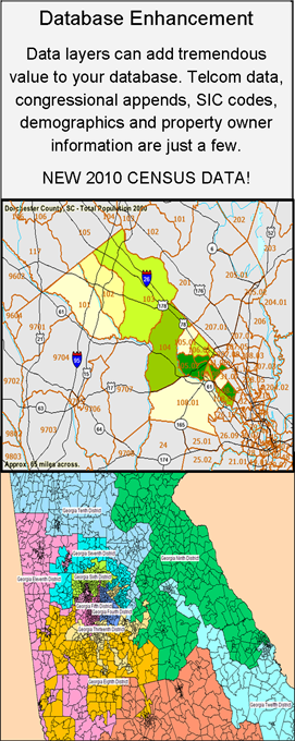
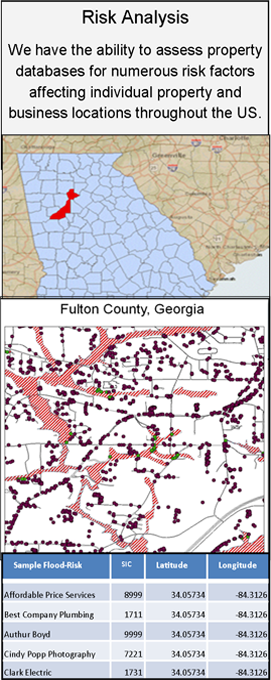
With over 20 years of experience in GIS and Database Services, we have completed numerous multifaceted projects for private, public and government institutions. We have the ability and expertise to utilize all of the major GIS software solutions and integrate the most applicable aspects from various sources to create a custom solution according to your specific needs.
- Custom Mapping Solutions
- Database Design
- Enhancements Vectorization
- Format Conversion
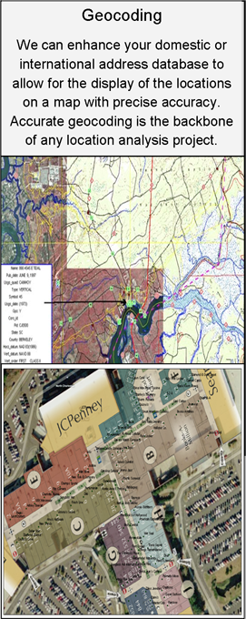
- Geocoding
- Geo Referencing
- 3D/2D Mapping
- Line of Sight Analysis
- Drive Time Studies
- Distribution Reviews
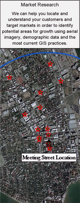
- Consumer/Customer Analysis
International Geocoding and Data Solutions
With numerous international datasets and an extensive network of partners spanning the globe, Geodata Consultants, Inc. is your international solution provider. We have the ability to geocode in over 220 countries across the globe, many to parcel and street address levels. We can handle your large scale international geocoding projects. Just a few countries in which we specialize include:
- United Kingdom
- Canada
- Germany
- France
- Switzerland
US Parcel Level Geocoding Services
Parcel geocodes are some of our most popular services. This precise append is based at the center of the registered land boundary file and is the most accurate form of batch level geocoding available today. Domestically, we have the ability to geocode to over 120 million US parcels.